
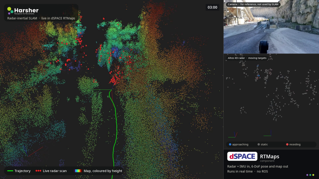
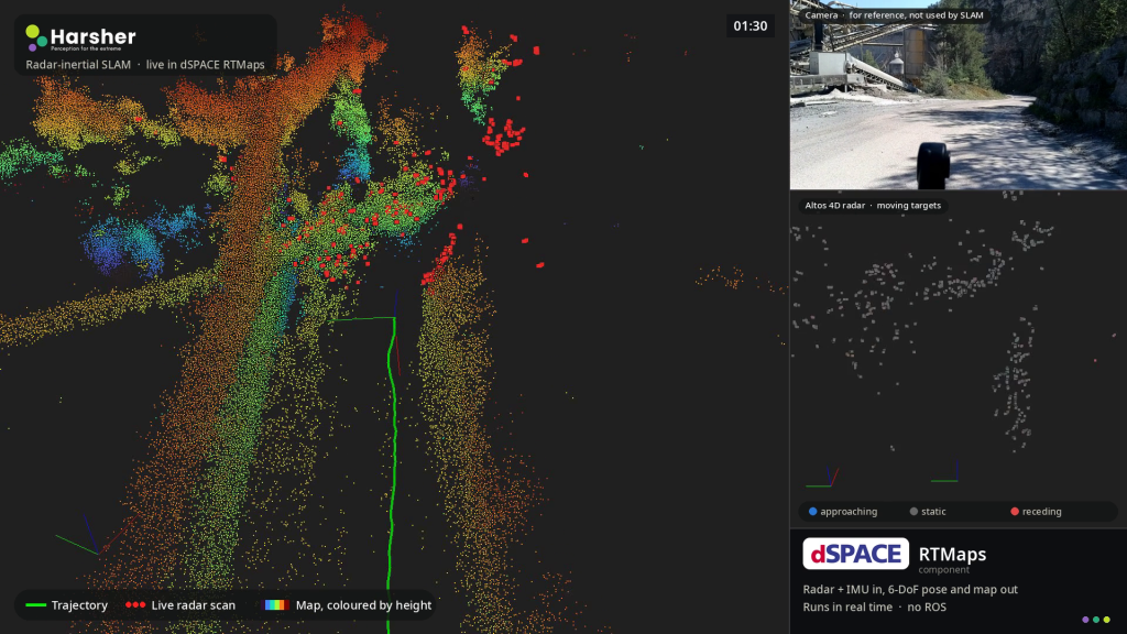
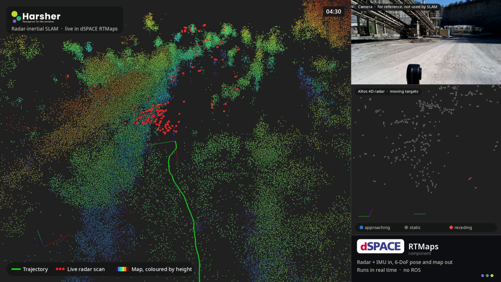
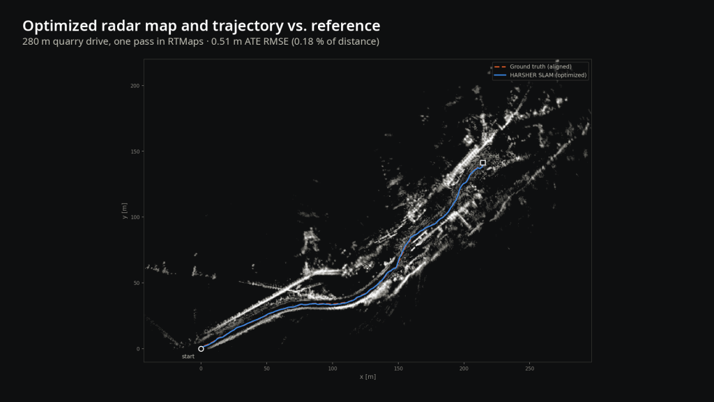
Dust, fog, rain and snow blind cameras and LiDAR sensors and that is exactly when autonomous machines in mining, quarrying, construction and agriculture still have to know where they are. The Radar SLAM by Harsher localizes and maps with 4D imaging radar, which sees through dust, fog, rain, snow and darkness, combined with an IMU. It gives vehicles and machines a precise 6-DoF pose and a 3D map of their surroundings when conventional perception stacks fail, including where satellite positioning is unreliable. On the Harsher quarry dataset, HARSHER SLAM tracked a 280 m drive with a trajectory error of 0.51 m (ATE RMSE, 0.18 % of the distance travelled) from radar and IMU alone, with no GNSS, LiDAR or camera.
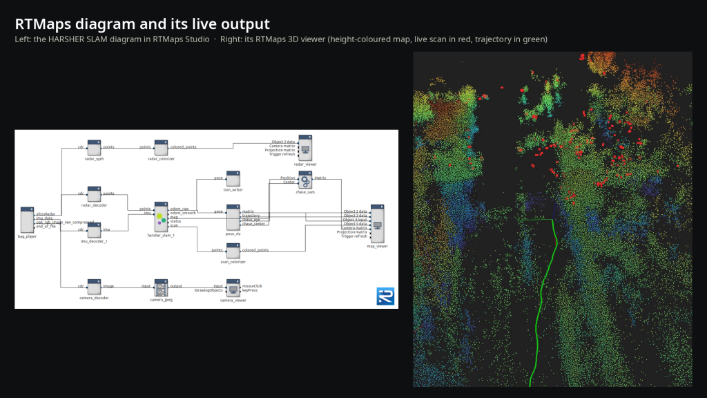
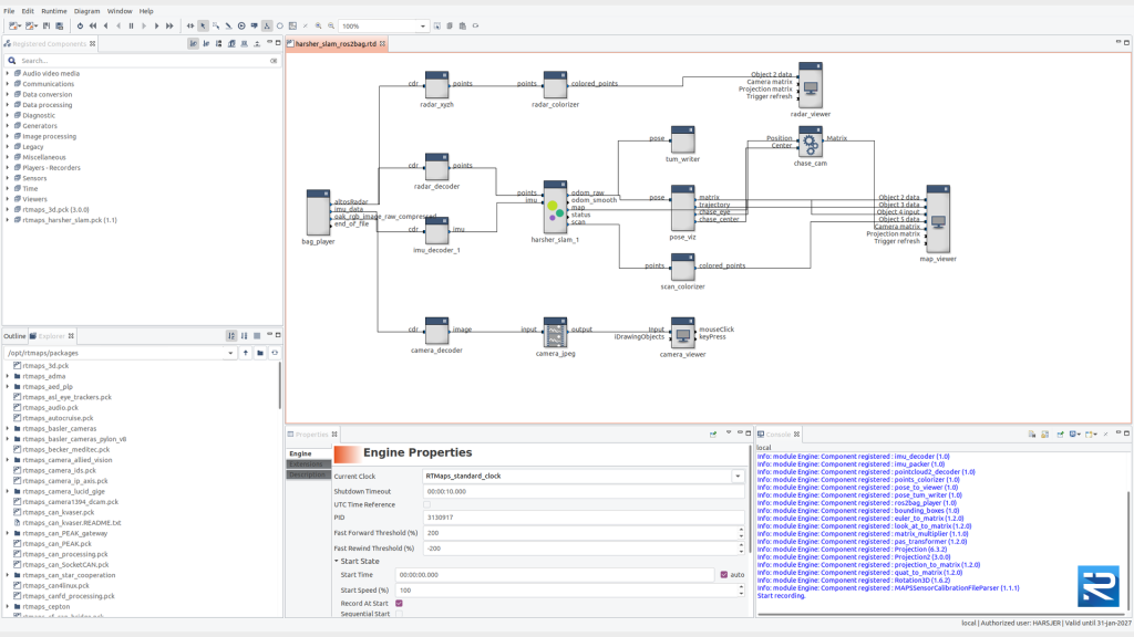
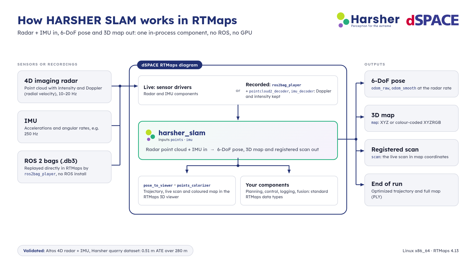
HARSHER SLAM runs inside RTMaps as a native component, with no ROS and no middleware. The package (`rtmaps_harsher_slam.pck`) provides:
At the end of a run, the optimized trajectory and the full-resolution map (PLY) are saved for offline use.
Inputs: radar points as `x, y, z[, intensity[, doppler]]` and IMU as accelerations and
angular rates.
Outputs: pose (`x, y, z, qx, qy, qz, qw`), map (XYZ or colour-coded
XYZRGB), registered scan, status.
Platform: RTMaps 4.13 on Linux x86_64.
BENEFITS AND KEY ADVANTAGES OF THE all-weather radar slam BY harsher

Harsher builds perception for the extreme: SLAM, radar localization and mapping for machines that work in harsh environments. Our systems keep localization and mapping running in dust, fog, severe weather and GPS-denied conditions, enabling continuous operation in mining (open-pit and underground) and construction automation. Harsher works with any radar platform for robust localization, and uses LiDAR for high-accuracy mapping.
Please, fill the form below.